Direct to satellite to mobile telecoms

A few years ago, I wrote an article about new project from AST Space Mobile which uses satellites to provide services to standard mobile telephones. Since then, a lot of progress has been made, but whilst satellite-based connectivity for standard mobiles is not yet fully mainstream, new services are getting closer as other tech companies also develop solutions. Based on what I have seen reported over the past year, we will not have to wait much longer for these new services, but availability in the “Global South” will take longer.

In February, The GSMA (trade association for mobile networks) will be holding its annual trade show called the Mobile Word Congress (MWC). In the lead up to MWC many network operators and handset makers use this event to launch new products and services. For 2024 we are already seeing plenty of announcements from the innovators planning direct to satellite to mobile services. More announcements may be in the pipeline, but currently I am aware of four direct mobile to satellite options emerging. Below we will explore four options. Two of these options rely on standard satellite signals and require compatible mobile phones. AST Space Mobile and StarLink use standard LTE/4G technology.

AST Space Mobile was the first operators to go public with to promote direct to satellite LTE services. AST Space Mobile initially secured funding from the Vodafone group which is a multi-national company. Recently they announced further funding from AT&T and Google.

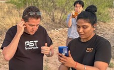
AST tested its Blue Walker-3 satellite in April 2023 with the first call being made from Texas USA to the Rakuten Group in Japan using a standard Samsung S22 Android mobile.

Already, the company has agreements and understandings in place with around 40 partners including Orange, Telefonica and MTN, although it is expected that the first commercial operations are likely to be launched in the USA. The appearance of MTN in the partnership list will be good for Africa as MTN is a major player in many countries throughout Africa. The commercial work with the AST network appears to be the most advanced at this time, but SpaceX with its StarLink network could accelerate its partnership model quickly.

As a long-established satellite telephone operator, Iridium has had a bumpy start in its direct to mobile roadmap when its partnership with the chip maker Qualcomm failed. They have launched Project Stardust which will be based on open standards. Unlike the full LTE functionality offered by AST Space Mobile, Project Stardust uses standard L Band channels and will be initially limited to SOS and SMS text services with data arriving in the future. In addition to smartphones, the service is being designed so that it can be accessed by smaller devices like smart watches. Iridium plans to start testing in 2025 and then launch a commercial service in 2026.

Whilst this innovation is planned to be a direct mobile to satellite service, it does rely on a bespoke chipset being added to each handset. Whilst the tech is “Open sourced” the service will not be LTE/4G compatible but will operate direct on the Iridium L Band. There is an advantage to this approach as it uses the standard Iridium frequency spectrum and will be easier to roll out globally as there are less regulatory challenges.

SpaceX is possibly now the largest operator of satellite globally and well known for its StarLink internet service. Whilst StarLink has focused on its low-cost internet services, in January 2024, they tested services via one of their new and recently launched LTE/4G capable satellites and early testing is showing some great results. Very soon, text services will become available and in 2025, services will be expanded to data and voice. As this service is LTE/4G technology based, services can be accessed by any standard smartphone if the SIM card is registered to a telecoms partner like T-Mobile (USA), Salt (Switzerland). To date, there does not appear to be any global south partners but given that StarLink is operating in many Global South but this could change in the months ahead.  

With the launch of the Apple iPhone 14, Apple included a basic satellite SOS function via the GlobalStar satellite network. The Apple approach is not LTE based, but still useful for people who may be in distress in remote locations. Apple is working with GlobalStar to provide internet access in the future. Whilst the SOS function is very useful, Apple technology is very expensive and the GlobalStar network is limited to the Americas, Europe Australia and parts of Asia and the Middle East. Apple satellite SOS will not work in most parts of Africa.

The answer is a definite yes! But it’s important to weigh up the various options before selecting any of the technologies. The best option to select will depend on where the technology will be used and what functionality will be required. Currently the Apple SOS feature is free of charge but likely to become a pay for service after the end of 2024. This service would be an excellent choice for people who occasionally venture into remote locations in developed countries, but the iPhone 14 or newer is needed. The Apple / GlobalStar service is the only Direct satellite service operating at this time.

Iridium will be a good option as its global and provided by a well-established global satellite network. Whilst Iridium is promoting open standards, unfortunately to access this service, phones need to be sourced that has the compatible technology built in. When available Iridium could be the best alternative to buying a standard satellite telephone. In the International Aid sector, when Iridium goes live, this option could be my first choice for security telecoms.

Finally, we are left with StarLink and AST Space Mobile which is pure direct to satellite LTE/4G services. In a nutshell, these services will be compatible with any standard GSM phone. Based on current announcements from these operators, services can only by bought through a national telecoms partner. From a “Security Telecoms” point of view, for now we must assume that telecoms operators in some countries could be forced to disable services by local governments in the same way as they do for terrestrial networks. So, for now, it’s important not to give up traditional satellite telephones such as Inmarsat, Iridium and Thuraya.

Longer term, it is likely that Direct Satellite to Mobile will get through the various regulatory challenges and could push traditional satellite operators aside. Out of the big three, Iridium is in a good place for the new services, but Inmarsat and Thuraya are unlikely to be offering LTE services from their GEOS fleet and there orbits are significantly higher.

Direct to satellite services (LTE/4G) is a rapidly evolving sector. Apple is the only technology with a live service now and limited to SOS SMS only via a app. As the technology evolves, so will the regulatory challenges. The global mobile sector is massive and well-financed and would object to satellite operators joining the business as competition. Some mobile networks are owned by national government who would impose bans on this new tech if it were to threaten revenues. Currently the emerging business models seem to be based on partnerships where national telecoms providers work with the satellite operators to provide roaming options to extend terrestrial service into remote and rural areas. My gut feeling is that StarLink has the funding and capacity to deliver services at scale and most likely to emerge as the leading direct to satellite LTE/4G provider within the next three years.

How does ICT support disaster response?

Across the aid sector, the opinion is divided about the sort of role ICT can play in disaster response. In some organisations such as WFP, technicians are sent with the first wave of responders as experience has proven that reliable communications and power supplies are needed for the very beginning of the response. Other organisations senior managers often question why “IT” needs to be involved at all. Some of these misconceptions is often flavoured by an individual’s personal experience with an IT team at the transactional level.  Simple tasks such as setting up printers, resetting passwords and de-fluffing mice might be the only activity people might see from technicians.  

In a fast moving emergency response, the humanitarian team will need to use reliable radio, satellite and other communications to coordinate the response. The flow of information is important between the response teams and their coordinators back at HQ. For the high profile responses, media teams will need to get video footage from the frontline so that the organisation can hit the headlines with the latest report from the response teams.  

In this article, I am going to set out the increasingly important need for technology in the emergency setting and explain how the IT department has worked over the past year to build a team of emergency responders, invested in quick deploy equipment and have developed some clear standard operating procedures to define the role technicians will play in future disaster responses.  

What role does ICT play in emergencies?
When a disaster happens, the affected population may have critical needs for food, water, shelter and medical care. For children, there will be additional requirements such as child protection/ safeguarding and education. The 21st centary NGO may need to rely on a range of digital services to deliver some of the urgent aid to the affected community. Whilst bringing aid to the emergency, the responders are also required to take care of their own safety and security. In all of this activity, Technicians have a very important role to play as the technology used in an emergency setting may be wide ranging and complex.  

The immediate priority is to set up communications so that the response team can operate. Typically this will consists of portable satellite communications such as Thuraya and Iridium for voice communications and BGAN for data. As these systems are expensive to run and have limited capacity, the communications setup will be scaled up to high capacity satellite internet systems (VSAT) and where needed, radio systems can be established so that staff have at least 2 forms of communications device (Most organisations require redundant communications as part of a security policy).
Beyond the communications, the technicians are on hand to ensure that safe power suppliers are provided and that IT infrastructure is quickly established so that all of the response team can start to access internet based services.

 Within the first 48 hours of arrival, the technicians will have established the technology for the operational base from where the emergency will be managed. Beyond 48 hours, a more accurate picture starts to emerge about how large the response will be, the geographical cover and how many sites will need to be set up.  The technicians on the ground will be working closely with the wider humanitarian team to design the communications and technology for the response, build the budget and define the procurement plan.

 In addition to the infrastructure, the technicians may be involved in further technology related tasks, here are just a few examples:

·         Fleet management technology and tracking.
·         Setting up complex short range radio communication
·         Assessing power needs and then setting up power supplies
·         Implementing UAVs (drones)
·         Providing technology solutions for the communities affected by the disaster.
·         Solar energy solutions
·         Deploying IOT (Internet of things) – e.g. remote sensors etc.  

In addition to the technology design and delivery tasking, the technicians will engage other organisations such as Nethope and the Emergency Telecoms Cluster so that technology based activities on the ground can be coordinated.  

Effectively the technical specialists have knowledge and expertise to deliver the required solutions in just about any environment, even at sea!

The people

Our approach has been to build a virtual team from volunteers who are already in the existing ICT global workforce. This model is sustainable and cheaper to deliver than having a dedicated team of people on continuous standby. This way of working will bring a range of further benefits as follows:


·         As all team members have a full time role within Save the Children’s ICT team, they will already know our technology standards and will be very familiar our current ICT procedures and standards
·         Team members are based in all regions which mean that they can often get to the scene quickly.
·         Regionally based emergency responders will have more local knowledge of the technologies used in the same region, suppliers and how to manage importation of technology.
·         Language can sometimes be a barrier. Our model to use regional people means that very often they will speak local languages.  

We are developing SOPs for each region in which our local teams have a voice. We feel that the combination of our global subject matter experts in emergency response and the local knowledge of our regional teams means that we can develop solutions which are appropriate to the sort of emergencies in each region and what sort of technologies are in common use.  

Our ICT global workforce is already familiar with Save the Children standard technology (which we also use for emergency response). The existing skills needed topping up with some additional subjects such as quick deploy VSAT, communications planning and emergency response management. A programme of course were delivered in the UK, Nepal, Kenya, Panama and Sierra Leone to build these skills.

We have already procured quick deploy equipment which is now located in Nairobi and Panama City. This equipment consists of a quick deploy VSAT, wireless access points and other technologies which allows us to quickly provide fast internet access for an emergency response office for a fixed monthly price.

 The Kit
For the countries which are at risk of disaster, but do not permit the import of such technologies, we are working closely with IT teams in these places to develop local emergency response solutions. Myanmar is one such country where we would not be allowed to import our global kits, but we can procure a local solution for internal use within Myanmar.  

The kits have been designed is such a way so that they can be carried on normal commercial flights. We have tested this model twice. Firstly an actual deployment from UK to Haiti, and then later on, we tested the model again when we relocated a new system from the UK to Kenya with just one staff member!  (Using porters at the airport of course!).  

The VSAT is also complimented with a framework agreement which allows us to access a global network of satellites at preferential rates. Typically we would anticipate a fixed fee of around $5,000 per month to run a connection with no limits of the volume of data sent/received. Some people might think this to be expensive, but consider this. The BGAN internet terminal (which is small and compact) costs $5 per MB, so for $5,000 you will only get 1GB of data. For those of you with data-packages on 3G phones, you might understand why 1GB of data would be insufficient for a team of responders.  

Not all emergencies require VSAT. There might be emergencies such as drought or pandemics we might respond to. Responses might be in places where 3G cover is good. We have some technology in our kits to allow us to use 3G and 4G coverage to provide a wireless network for our teams. This technology along with a couple of wireless access points will easily fit into a medium sized peli-case.

Before attending the training, we asked our students to participate in some online VSAT training hosted by the Global VSAT Forum (GVF), so that all students arrived at the course with a detailed understanding of the VSAT Theory
Each course lasted for about 5 days and incorporated an emergency scenario. As a result of this programme, we have now trained around 30 people.

If we deploy technicians to a response, we are likely to send two people. There are two defined roles as follows:

 Emergency ICT & Energy Team Leader: Responsible for the overall response and works closely with Global and regional managers to coordinate the response. Also engages with external organisations such as the ETC where needed. Also responsible for the high level and complex design of technology solutions for the response.

Deputy Emergency ICT & Energy Team Leader: Responsible for the delivery of user facing services and manages the day to day activities of any local IT people who are recruited for the emergency. Works closely with the Logistics team to ensure that the ICT supply chain runs smoothly.

As we have people based in all regions, one or both of the roles might even be filled by people already based in the country where the disaster has taken place.


How ICT can assist maritime search and rescue operations

Conflicts in the Middle East and Africa has led to a significant movement of people. Each week, thousands of people are risking their lives to reach Europe by attempting to cross the Mediterranean Sea. So far and estimated number of 3,000 people have already drowned this year. Save the Children and other NGOs have launched ships to rescue the many people who put to sea in unseaworthy boats. On board the rescue ships, the NGOs take care of immediate medical needs, provide food and water and transport the rescued people to a safe port in Europe where they will be looked after by the authorities.  

Technology has a very important role in support Search and Rescue (SAR) operations. Being on a ship has a lot of similarities to working in a remote field site ashore. Similar technologies are used, but there are also technologies used in such an operation which are unique to the marine environment. In this article, we will explore the technologies used to support SAR operations.

Operational overview
The movement of people from Turkey to Greece has significantly reduced due to the deal reached between the EU and the Turkish Government. Further west, the situation is very different as people leave the shores of Libya to attempt the long and treacherous journey to the Italy, Malta and other destinations. Save the Children, MOAS, MSF and other NGOs are running search and rescue ships under the coordination of the Italian Coastguard. This operation has become even more necessary as people traffickers are sending boats to sea of ever decreasing quality. In some cases boats are being sent with just about enough fuel to reach the areas where rescue ships operate.  

 The boats are often overloaded which means that getting people off them is dangerous and requires a lot of communication with the people on board in advance of rescue. NGOs are using cultural mediators who have the language skills to explain to people how to leave the boat safely. The main danger is capsize of the boat caused by all people on board rushing to the same side of the boat to be rescued.

It is now the peak season for migration as the sea is fairly calm. But rescue is still needed when weather conditions deteriorate as the boats continue to put to sea. The traffickers just sell off tickets at half price. People are taking huge risks as the likelihood of people coming to harm increases significantly in bad weather.  

Airborne Surveillance
moas_droneUnmanned Airborne Vehicles (UAVs) are being used by MOAS. In humanitarian work, we try to avoid the term “Drones” as military drones have been used in many places to fight wars. The use of UAVs is well established in disaster response where small battery powered UAVs are used to gather aerial images.

MOAS has partnered with Schiebel and have two long range UAVs on the rescue ship. These UAVs are miniature helicopters with powerful engines running on aviation fuel. They are controlled from a ops room on the ship by trained pilots.

When on deployment, these UAVs will cover a large area of up to 100 miles from the ship. From the on-board cameras, boats needing rescue can be identified and locations shared with the Coastguard. Depending on the location of SAR ships, the nearest ship will be tasked to conduct a rescue. This could be the MOAS ship if it was the nearest.

Tracking the SAR FleetaisOn land, safety and security managers are often keen to know the whereabouts of vehicles on the road in places where the situation is insecure.  In maritime operations, there are also security risks to ships from threats such as piracy. There have been incidents reported by some  ships and as a result, most organizations involved in the effort have developed procedures to deal with such situations.  

Tracking the locations of ships is very easy and does not require much up-front investment in technology as any ship over 300 tons which operates outside of national waters is required to carry the Automatic Identification System (AIS) under the IMO SOLAS regulations. This requirement was introduced in 2002 and has been extended in some countries to cover national coastal and inland waters.  

AIS operates on the VHF radio frequency at a maximum power of 12.5W. Each ship transmits its location, speed, heading, identity and other information about the ship. The original intention of AIS was for collision avoidance (supplementing RADAR which displayed just displayed range and bearing of objects which reflected a signal). As the system was designed for the purposes of collision avoidance, the system was never intended by the IMO to be a long range tracking service. However long range tracking has evolved thanks for private sector and the internet .

AIS signals are in the public domain. It’s very easy to buy an AIS receiver for $100 and with some ingenuity, the data can be displayed on a google map. Some hobbyist have demonstrated this though setting up AIS websites which display live data from ships at sea. John Ambler created a google map for the busy waters surrounding the Isle of Wight on the south coast of England (see http://www.john-ambler.com/ais/google.html).

Commercial AIS tracking websites such as MarineTraffic.com have appeared and brings together a global network of people operating AIS receivers. Many of these sites are free to view, but for a fee, there are more advanced functions available. In recent years, low orbiting satellites have been equipped with AIS receivers so that ships can be located outside of the areas covered by the land based AIS stations. The AIS websites will normally charge a fee to access the Satellite AIS. As satellite AIS is evolving, there can be significant gaps of up to 8 hours between position reports.

Another benefit of using the “paid for” services is that organizations can mark out areas on the map so that operations can be informed about key events such as when a ship leaves port, arrives at its destination or enters into a specific area. In some operations, SAR ships will be required to keep a certain distance from the coast and only allowed to enter a specific area to conduct a rescue. Alerts can be set up to let operations staff know when such areas are entered.

Emergency & routine communicationsgmdss
Many NGOs have safety and security policies which require there to be at least two separate modes of communication. On land, this may include radio and satellite communications. Local mobile networks are sometimes included if they are considered to be stable enough. The main purpose of such policies is to enable teams to be able to call for help from specific trusted contacts. As NGOs take to the sea and conduct SAR operations, the need to reach out for help when the rescue ship itself encounters a problem is covered under the various laws and standards which regulates ships (flag state & IMO).

All commercial ships deploying to sea are required to carry equipment which complies with the Global Maritime Distress and Safety System (GMDSS). For many years, ships have been equipped with various types of radio. In the late 1970’s the worlds very first commercial satellite communications network INMARSAT was introduced to shipping and later on was adopted by NGOs and other sectors working ashore. The complex array of radio and satellite communications was managed by the ships radio officer.

In the 1990s. GMDSS was launched and became a game changer. As a new standard, GMDSS integrated all modes of radio and satellite communications into a single control console where routine and/or distress messages could be sent easily at the push of a button. The design of GMDSS systems meant that all communications could be handed by the bridge crew thus making the role of the Radio Officer redundant.

There is a well-established system at sea where as soon as a distress is sent by any vessel, nearby ships are required to assist if they are able (and it’s safe to do so). Every part of the worlds ocean is covered by a capable rescue authority which coordinates a range of rescue assets ranging from helicopters to warships. Where NGOs commission ships for SAR operations, they should consider the safety and security aspect of communications as outsourced to the ship’s crew as the GMDS system on board will most likely exceeded any requirement stated in the NGO’s policy.

For routine communications, NGO teams will need their own ways to communicate with their operations people ashore. Mobile phone networks are fine for when the ship is alongside, but out at sea, satellite communications will be required for when the ship moves beyond mobile phone coverage which is typically limited to 10KM or less from the coast. Save the Children have set up Iridium for its communications on its ship as Iridium external antennas are Omni-directional. For on-board communications between the team, short range UHF radios are used which are set up on IMO frequencies designated for on-board use.

Internet accesskvhAt sea, access to the internet is just as important as it is on land.  Whilst in harbour, it’s easy to connect to internet services provided by mobile networks. Further offshore the internet needs to be provisioned through satellite services such as VSAT. On land, a VSAT dish is fixed to the ground and pointed at the satellite, shore based systems typically cost $4500. At sea, the ship is constantly moving which means more complex technology is required to keep the VSAT dish pointing at the satellite. If the dish is misaligned by anything greater than ½ degree, the signal is lost and internet fails.

Marine VSAT systems are much more expensive due to the technology involved. Typically the budget systems start out at $20,000 for the hardware. They tend not to track satellites very well in rough seas. If there is a high dependence on internet access, more robust and expensive systems costing as much as $40,000 will be needed. On top of this, there will be the monthly usage fees.

The technology is also quite expensive and complex to install. The larger systems need special consideration as the antennas and their protective domes  weigh a lot and installers need to work closely with the ship owners as these systems will have a minor effect on the overall ship’s stability.  

Save the Children  chartered a vessel which already had a VSAT installed. The KVH system is at the low end of the technology and limited to 1MB capacity which costs $4,000 a month to run. For the 12 crew on board, this is sufficient and the crew have been able to access online resources such as health information systems, email, conference calling and a tool used to collect information about the people rescued.  Many organizations are using tablets and Kobo software to collect anonymous information about the people rescued.  

Weather forecastingmet-office

Mariners are well trained in meteorology and its normal for ship crews to be able to access local weather information. As part of the GMDSS infrastructure, various coastal stations and coastguards broadcast weather forecasts several times a day. Weather information is also transmitted to GMDSS text based systems such as Navtex and Inmarsat C safety net. Generally these forecasts are limited to a 48 hours forecast window and covers a wide area.  

Save the Children is sourcing weather information the UK Met office. The forecast format provides a 5 day outlook. A fresh forecast is generated every 12 hours and sent directly to the ship by email. The forecast is for a specific location near to where rescues take place and gives the team information about predicted wind, wave and swell height. The format of the forecast was designed for the oil industry and includes wind data for a height of 100m above sea level – quite useful information for the MOAS UAV operators.

Good quality weather predictions could enhance the efficiency of the rescue operation. If sea conditions are predicted to worsen for a few days making it impossible to rescue, ships could use the downtime to return to port and replenish fuel etc.

Lessons learnt
​NGOs entering SAR operations may not have maritime experience at all, if they take the same approach to providing similar technology to what would be used on land, budget holders will be completely shocked at the complexities and costs of setting up the required technologies. It is really important that programme managers engage technical experts from the get go, preferably well before budgets are set. Technology at sea is a very specialist area which means that organizations may  need to look beyond their internal ICT teams if they do not have in house maritime expertise.

Great energy inventions

In the 1990’s Trevor Baylis a British inventor saw a TV program about the spread of AIDS in Africa. One of the ways to prevent the spread of AIDs and other diseases is through education and information using radio broadcasts. The dissemination of information over the airways requires the target audience to have radios. At the time, most radios needed mains power or batteries. Baylis recognised that access to electric would be a massive challenge and that another solution would be needed. baygen

Baylis immediately set to work and invented the first wind up radio which enabled the radio to be charged up by an internal dynamo operated by a hand crank.  He eventually went on to form Freeplay energy which is still operating today and still innovating new products.

In addition to radio receivers, Freeplay also produce a wide range of other products which are well suited to remote settings where electricity remains a challenge. The original wind up technology has been refined over the years and is more efficient. Freeplay has incorporated solar technology into their solutions which means that radios can be powered throughout the day without any need to turn the handle! I am pleased they have retained the concept as radios can still be used if they run out of charge during the night.

Over the years, I have seen similar products from other manufactures, but during a recent evaluations of Freeplay products, I was impressed by the quality of build. For remote locations, any technology must be built strong enough to withstand the harsh conditions and be reliable. This is really important as once the technology is shipped, it’s not easy to fly it back to the factory for a replacement.

 In this article, we will explore some of the Freeplay product and discover how they can add a lot of value to communities which are remote or affected by a crisis.

As an organization, Freeplay manufactures small portable products for families. The technology is targeted at a number of markets such as emergency preparedness, aid & development and any consumer who engages in outdoor activities such as camping.

Encore Radio
encoreThis radio is well suited for use in developing nations. The radio has been cleverly designed so that it can receive longer range broadcasts over two SW bands. For local broadcasts, the radio can receive AM and FM. I was also impressed with the built in recording function which allows the radio to record broadcasts and save them to memory cards in MP3 format via the built in card reader.

In addition to recording programs in MP3 format, these radios can be used in schools as a tool to enhance education. Any MP3 content can be played. Up to 125 audio books can be stored on a 32GB SD card!

Power for the radio and its two inbuilt bright LED lights are charged up from the crank handle at the rear or the small solar panel on the top. (A larger external solar panel is also included).

This is not the only radio made by Freeplay, there are others available which are designed for different uses such as emergency preparedness.

Energy Hub
hub
The Energy Hub is a small solar system designed for a small household. The kit comes with a controller and two lights (as pictured). An external solar panel can charge the battery up in 6 hours to full capacity. On a full charge, two bulbs on high setting will run for 8 hours. A single bulb on 50% setting will run for 32 hours.

The cables for the lights and panel are sufficiently long enough to allow for permanent installation in a small family hut.

LanternReliance Lantern
Over the years, I have seen a number of lanterns but this one really impresses me not just for the build quality, but for the overall design. Its built to withstand weather and shock and can provide light up to 45 hours on a single charge. It also has a built in Siren which is really useful in some applications.

The Lantern Library:  Good technology can cost money, and I have heard of innovative projects such as “Lantern Libraries” where lanterns are held by schools and kept charged up. The idea is for pupils to borrow a lantern from school (sometimes for a small cost recovery fee) to take home. In darkness, the pupil has a light to see their way home, and at home, the pupil can study using the light. The addition of the built-in alarm just makes the whole concept better as a child can activate it if he/she is attached.

Conclusion.
Freeplay’s original concept to connect communities to broadcasters is just as relevant today as it was back in the 1990s when Trevor Baylis launched his first wind up products. In the Aid and Development sector, mobile phone networks are used by the UN and NGOs to interact with communities. Whether it’s a cash voucher system, SMS reminders for appointments at clinics or community engagement via collection of feedback over SMS, mobile phones are needed and they need to be charged. This requirement has not escaped Freeplay as in the three technologies we reviewed, all of them have built in sockets and supplied with the appropriate adaptors to charge up most mobile phones and other USB devices.

Keeping up to date to stay safe.

NGOs work in some of the most unstable places on this planet. In some locations there are serious risks from potential natural disasters such as cyclones, volcanoes and earthquakes. Staff safety is also put at risk by man-made events such as war, acts of terrorism or public protest.

Organisations have a duty to keep people safe and will have policies in place to govern how aid is delivered in such a way that risks to staff are reduced.

The flow of information about events is regarded as very important for two reasons:  Firstly if the event happens in a place where the organisation operates, accurate information will enable decision makers to take the correct actions to keep staff safe. Secondly, event information is useful to organisations far away from an event. For example, an alert about a severe earthquake would give emergency response personnel a heads up that they might soon be deployed.

In this article, we will explore some warning and monitoring tools – some are free of charge, others need to be paid for. Note – I have saved the best to last!

Free alerts
There are many organisation on the web which send out alerts when significant natural events take place. The Global Disaster Alert and Coordination System (GDACS) is supported by the UN and EU. GDACS is constantly kept up date with many events ranging from minor to major. Coverage is fully global and its free to set up an account.

gdacs

Anyone can set up an account at www.gdacs.org. As soon as the account is active, users will be able to customise settings so that they can receive alerts and updates about various types of natural disaster. For those with a specific interested in a certain geographical region or country, the account can be set to send alerts which only cover the geographical area of interest.

For major natural events such as strong earthquakes near population centres, cyclones and Tsunami alerts, GDACs will send out SMS alerts to subscribers in addition to email messages.

For those with Smartphones, GDACs can be accessed via a fee app.

Other free resources: In addition to GDACs, there are various local options around the world – especially in areas where there are frequent risks. The USGS runs an alert service for seismic events which covers the globe. Weather is a severe risk to the USA and they have set up the National Hurricane Centre (part of NOAA). Their website is a great place to track hurricanes as they form out to sea. Although NOAA is operated by the US Government, the area of coverage includes the Caribbean.

NOAA used to push email and text alerts. This stopped a few years ago as messaging was outsourced to third parties. The link to the NOAA site will take you to a list of third parties who distribute information – some do it for free.

United States Geographical Survey: https://sslearthquake.usgs.gov/ens/ United States Weather (NOAA) http://www.weather.gov/subscribe

Commercial Solutions
International SOSInternational SOS / Control Risks: In addition to natural disasters, travellers need to know about manmade events such as riots, demonstrations, war, acts of terrorism and other risks. Many NGOs use a service which is provided jointly by International SOS and Control risks. Organisations often buy in this service along with medical insurance. Staff who belong to organisations  which have subscribed to this service will be able to keep up to date about local  significant events which can present a risk to safety. The app also links users to country information useful to travellers – normally information about visas, security, travel, medical and culture information for business travellers. A button is also included so that the local number for International SOS is dialled should medical assistance be required.

Safeture – Global Warning System (GWS): Whilst free solutions such as GDACs are free, they should only be regarded as one jigsaw in the big safety and security picture. International SOS/Control Risks are two very reputable organisations who provide really reliable information from its network of global agents. Safeture GWS to me is the Gold standard as this system is much more than a means to access information or connect people to medical assistance. GWS connects staff to their safety and security teams in a very ingenious way using the technology that exists in may smart phones.

GWS an advanced safety and security management system. The control portal allows managers to sign on and view current information alerts for all countries where staff are based. Safeture has developed a system which captures information from a wide variety of sources ranging from local news services to global systems like GDACs. For events of high importance such as Tsunami alerts, the system is designed to get the alerts to staff automatically as services such as USGS and GDACs are regarded as trusted sources. Real people will monitor further news following any event and will rerelease information as soon as its been verified (This happens quickly by the way).

Important messages are delivered to users via SMS as well as the internet App.

The screen shot below shows the main overview screen. Staff locations are displayed along with a link so that managers can send messages directly to staff by SMS. In an event such as a terrorist attack,  this system gives organisations the ability to track staff, account for their safety and to send instructions  – perhaps informing them of a safe place to muster.

GWS1

GWS2
GWS can be downloaded as an app onto Android, Apple, Blackberry and Microsoft smartphones.

The GWS app utilises several features on the smartphone to provide the end user with a complete safety and security service.  The app uses a combination of GPS and network triangulation to establish the users location. This enables the app to display relevant national information. Users can also display information for other countries. GPS is also used to report the users location back to the system so that managers can monitor.

The SOS button brings up a new screen which allows the user to call local emergency services such as the police. If such a call is made, notification goes back to the system to let managers know that an SOS call has been made.

Staff may not wish to be monitored all of the time if they are present in their home countries and “off duty” To protect the privacy of the user, the smart phone can be set to only report which country the user is located, but not where in that country.

In addition to news and alerts, WGS also displays country information. The content is similar to what is provided by Control Risks, but organisations can also add further information such as country office locations, contact lists, and curfew information.

GWS4GWS3

Conclusion
In highly insecure environments this is possibly the most effective security solution I have seen to date. Specialist tracking devices can attract the wrong sort of information. The ability to deliver an information and tracking system on devices which people already own is just pure ingenuity. This system will work well in most places where there is basic mobile coverage. In places where there is no internet access, staff will be able to receive important alerts via SMS and then send back their locations by SMS by pressing a button on the handset. Safeture GWS would be a great investment for any organisation who take safety and security seriously.

Digital aid for refugees

For many years, IT and telecoms have had a very important role to play in most humanitarian responses. The main focus has been to provide reliable communications and connectivity to aid workers who are responding to a crisis. Organisations such as the Emergency Telecoms Cluster (ETC) exist to provide the telecoms and connectivity which emergency responders rely on. In a crisis, it has been recognised that not only aid workers need access to the internet, the wider affected population also needs to access the internet as well. Organisations are starting to provide services to affected populations already. This year, the ETC have fully embraced the concept into its ETC2020 strategy and have established a new working group consisting of Save the Children, Nethope and the CDAC Network. This new workgroup is exploring how we can deliver connectivity to the affected populations.

As the ETC working group is holding meetings to discuss what the “services to affected communities” will look like, Nethope (an IT membership body run by over 25 NGOs) is already on the ground making a difference. In this article, we will explore what is being done to provide connectivity and some of the challenges we face

The Syrian crisis has led to many people being displaced in Europe. More than 11 million people have been displaced which makes this situation the largest mass movement of population since world war 2. More than 4 million people have fled the country completely. Each day, refugees by the hundreds to thousands are on the move. Until a few years ago, Syrians lived in cities which had reliable infrastructure and plenty of internet connectivity. This mobilised population of refugees are educated, and some have money. It has been reported that the three questions asked when a refugee lands are:  1) Where am I? (They are wanting confirmation that they have reached the safety of the EU), 2) How can they get access to the internet and 3) where can they buy food.

GSM mastWithin the wider humanitarian community, the concept of providing connectivity to refugees is being regarded almost with the same importance as food, water and shelter. Reliable internet access is an enabler as organisations are starting to use cash voucher systems over mobile networks to deliver aid. The monitoring and evaluation specialist use mobile technologies to get feedback from affected populations about the aid they received. GSM masts are being set up in and around some of the world’s largest refugee camps where people will be living for long periods of time. At the recent humanitarian summit in Geneva, UNHCR stated that across all camos, the average length of stay is 17 years. With such vast numbers of people staying in these camps for long periods, its easy to understand why the major network operators are keen to get coverage to the camp. It has been said that the Safricom GSM mast in the Dadaab camp has the second highest amount of financial transactions each day via its MPESA system.

Connectivity is not where it ends, it’s what we do with that connectivity which is really important. Information is power and if we can get the correct sort of information to the people who needs it, then there is an opportunity to disrupt established practices for the betterment of all. One example of this disruption is where farmers in remote villages have been linked to market prices in the cities far away. This information has enabled the farmers to negotiate better prices from the middlemen who moves the produce to market. This has had a very positive impact on some remote communities.

 So whilst there are plenty of examples of technology making a difference in places where things are more settled, there is also a need to provide connectivity to people in the time of crisis. This needs to be done from the get-go. For example following an earthquake in an urban setting, alongside medical and rescue people, the telecoms engineer is also an emergency responder. Bringing mobile networks back online is essential as it means that people who are entrapped will be able to call for help using a mobile phone. There is some solid data from Haiti to support this.

Returning to the Syrian Crisis, connectivity is needed for a mobile population. Organisations like the Nethope are responding and have plans to establish a line of internet hotspots along the migration routes in Europe. The main networks have gaps, or where there is coverage, the network is not robust enough to deal with the vast number of users trying to connect. Nethope and its members are working towards a solution which will make a difference.

nethope

The programme Nethope is running is very thoughtful as they are not just creating hotspots, they have thought through how the connectivity will be used.

Cyber security is the top priority. Alongside the physical war, a cyber war is also being waged. The population is running away from danger and may still have families inside of Syria. On this basis, networks need to be secure so that no information can leak out which could place relatives who remain in Syria in danger. There has already been reports of murders following information gained through a Skype spoofing act. Nethope are co-opting some of the best brains from Cisco to make its network secure.

  • Mobile smartphones need power, so Nethope will set up charging stations at every site where a hotspot is set up.
  • Information is needed so that refugees can find out where they can access services such as health care, shelter and so on.
  • Children are not being educated, so there is a plan to develop and roll out an education app which can be accessed at all points along the migration route.


All of this costs money and Nethope has launched an appeal. More information about this project can be found online at www.nethope.org.

Conclusion
It is clear that telecoms and IT have a major role to play now in humanitarian response. It is now important that during any emergency response that senior telecoms/IT people are brought into the response senior leadership teams as IT and communications is starting to touch everything we do. The techies have a lot to offer any emergency response and should not be regarded as “the geek who just fixes computers”.


UN rolls out digital radio – Do NGOs need to throw away existing radios?

Short range VHF radio communications is changing for the better. For many years many UN agencies and NGOs have used analogue radio systems. Many leading manufactures like Motorola are ditching the analogue almost completely in favour of digital technologies. Towards the end of 2014,  Motorola stopped producing its popular GP and GM series radios.

Recently the Emergency Telecommunications Cluster  (ETC) in South Sudan sent out an email to agencies and NGOs to inform everyone what the new DP and DM MotoTRBO radios would become the new standard. They also provided a list of local resellers where NGOs could buy the new radios. Some NGOs started to worry that all radios would need to be replaced. In this article, I want to set minds at rest and explain why NGOs do not need to ditch the analogue radios quite yet.ETC

Before I get into the details about the new radio technology, here is a little background information about the Emergency Telecommunications Cluster.

The ETC was formed as part of the wider cluster system by the Inter-Agency Standing Committee. The original mandate was to provide telecommunications, connectivity and basic IT support when the cluster system is activated during an emergency response. This original mandate will be expanded to other areas under the new ETC2020 strategy.

Currently the ETC is providing services inclusive of VHF radio networks in South Sudan, Iraq, West Africa, Central African Republic, Yemen, Syria and Nepal. To date, the ETC have provided relay stations with supports analogue radios such as the GM360 and GP380. The ETC will begin to roll out digital networks over the next few years which will work alongside existing analogue networks. The ETC will continue to keep these analogue networks running until 2020. Please visit
http://www.etcluster.org
for more information.

Radios
Digital VHF  – How this affects NGOs
In 2014, many UN agencies agreed to use the MotoTRBO DMR technology as the standard system. Many NGOs including Save the Children have already adopted the same standard.  This means that from now on, network providers such as WFP,ETC and UNDSS will be setting up digital networks for NGOs to use.

The adoption of the new digital standard does not mean we have to throw away all of the radios we currently use. The new MotoTRBO DM and DP models also work in analogue mode which means that the new radios will be compatible with the older GM and GP radios which are currently in use. VHF repeater stations are also digital but can also be set up so that analogue radios can be supported.

In locations where the ETC is providing VHF Relay coverage, analogue will continue to be supported alongside any new digital services until 2020. As the new radios can be set up to work with both technologies,  the new radios will be able to communicate with older models on the analogue channels. Organisations will need to develop a strategy to switch to digital completely after 2020 or set up their own repeaters.

In places where the ETC or other UN agencies do not provide a network, organisations will have complete control and should develop a switchover strategy which suits each organisation. The best approach is for organisations to work up a strategy for each country rather than to impose a global deadline. In places where NGOs plan to set up completely new networks, digital should be used from the get-go. For places where already networks are well established, over time new digital radios will be added as older analogue radios are taken out of service due to age, wear and tear. In some countries, organisations are using DR3000 repeaters in analogue mode. These repeaters are digital ready and it’s a fairly simple task to move from analogue to digital mode.  It is clear that different countries will move to digital at a different pace to others, but with the correct planning, its possible to  design hybrid networks which will utilise analogue and digital channels thus making the transition easier.

What benefits will digital deliver?
With the analogue networks, the quality of the audio will diminish the further away the  mobile station is from the base. With a digital network, the call quality remains the same out to the edge. As the signal weakens, the audio becomes poor very quickly.

range

Digital networks allows for many more functions. Repeaters can be joined up via the internet so that calls can be made between cities. The practical use of radios will also change on a digital system. It’s possible to make private calls between radios without disturbing all other radios on the network. Of course the useful ability to call all stations with a broadcast is still available.

Digital radio is more efficient. For each frequency an organisation is licensed to use, two voice channels can be used (Only one channel per frequency is analogue). This is achieved by using Time Division Multiple Access (or TDMA), a method which is also used in mobiles phones and satellite technologies.  Voice calls are split up into separate time slots on the frequency, which does result in a very slight voice delay.

tdma

In digital modes, as the radio is only transmitting for ½
the time of analogue, battery life is extended by up to 40 %.

There are many other benefits to the digital system soch as
remote management tools, the ability to give each radio an ID, emergency calls,
and the ability to send text messages between radios

Conclusion
Digital VHF radio is definitely the future. The ETC has
taken a sensible approach by continuing to provide analogue support right out to
2020. NGOs should note the changes and start to develop plans to move to digital
over the next 5 years.